At the northern end of the island of Raasay one man famously built a road. After campaigning for years for a proper route to link his remote community, Arnish, with the island’s main highway, Malcolm MacLeod – better known as Calum – drew a blank. Frustrated at the lack of interest shown or action taken by the authorities, he took matters into his own hands and, after consuming the pages of Thomas Aitken’s manual Road Making and Maintenance: A Practical Treatise for Engineers, Surveyors and Others (London, 1900), set about building one himself.
Armed with little more than a pick and shovel and a wheelbarrow, Calum spent a decade (1964–1974) almost single handedly carving out and constructing the mile and three quarters of road between Brochel Castle and Arnish. All this he did while running a croft, raising a family, delivering the local post and working as an assistant lighthouse keeper on the neighbouring isle of Rona. He was also an avid writer and historian.

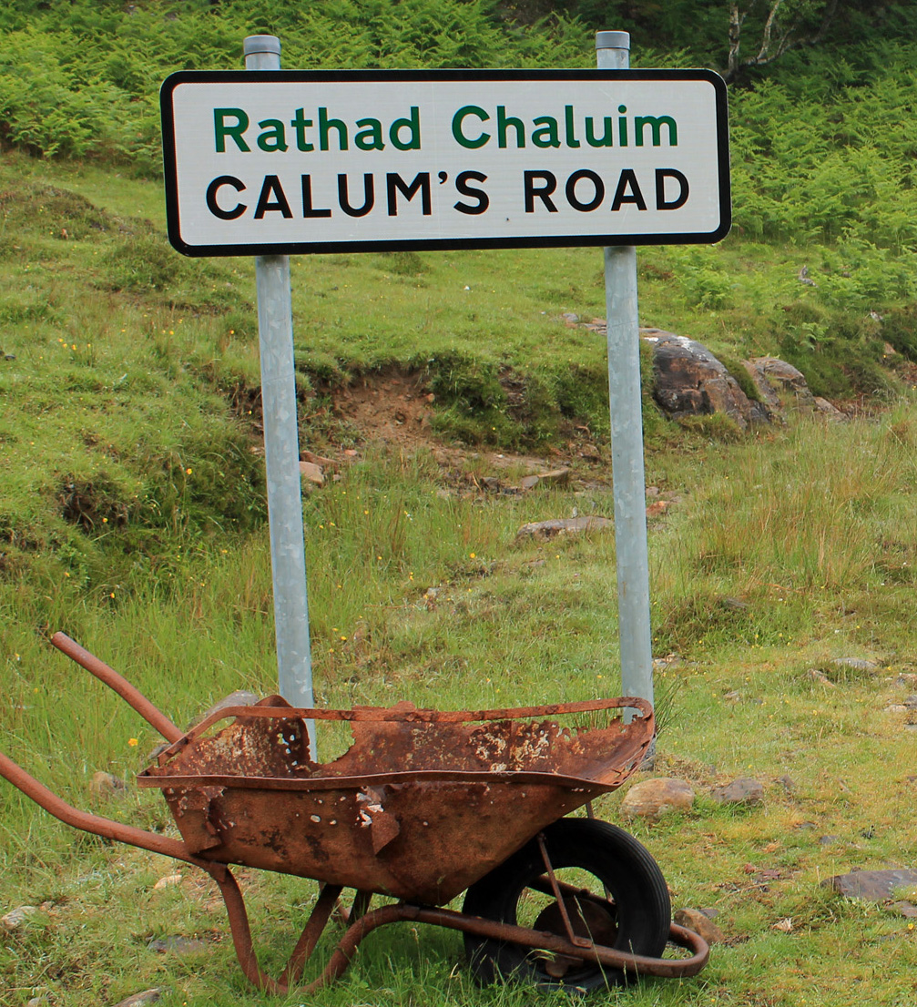
It became known as Calum’s Road and, several years after its completion, it was adopted by the local council and, in 1982 was surfaced and now forms an integral part of Raasay’s road network which, in truth, is fairly sparse. Complete with sign and commemorative cairn, it has also become something of a tourist attraction and has spawned a book (well worth a read) and both a stage and radio play and inspired several songs. Plans for a film have yet to come to fruition. Ironically, despite building a road and running an old Land Rover, Calum never possessed a driving licence.

While Calum had hoped his new road would help reverse the depopulation suffered by northern Raasay over the centuries, when he finished he and his wife Lexie were the last two residents of Arnish.
Calum’s Road was not, however, Calum MacLeod’s only achievement designed to make the north of the island more accessible. A decade earlier he and his brother Charles built a less well known route, a path linking Arnish, from where his father Donald hailed, with the island of Eilean Fladday (Fladda), where his mother Julia was born.

Known as Calum’s Path, it undoubtedly laid the foundations for his more famous road, providing Calum with both practical skills and the knowledge and confidence that where there was a will there was a way.
On this occasion, he did receive support from the local council. It commissioned the brothers to build the path, paying them each £35 a year for their labour and, over three winters from 1949 to 1952, they worked tirelessly on the new coastal track.
From the Mission House at Torran, to the north of Arnish, the path crossed a wooded headland before cutting across steep, rocky slopes that descended straight into the sea below. Stone terraces were pain-stakingly cut and constructed across the hillside to provide a level walkway. Nearing Fladda the trail wound its way down the hillside to meet a tidal causeway crossing the narrow channel to the island. Along the way Calum and his brother created rudimentary shelters from caves and overhanging rocks, positioning chairs in them, a tradition that appears to continue to this day. Given the remote location, rugged terrain and often hostile weather, its completion was quite an achievement.

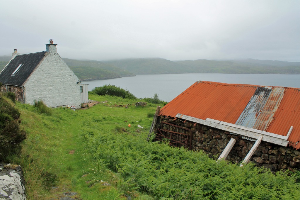
Fladda once housed a thriving crofting and fishing community and had its own small school. However, like the north of Raasay, it too was suffering from depopulation when Calum and his brother built their path. From a peak of 51 residents in 1891, its population had fallen to just 12 in 1951. In the 1920s, when five families lived on the island, residents unsuccessfully petitioned Inverness County Council for a road and footbridge from Raasay. The only way on to the island was by boat, or along a rough trail from Arnish which crossed remote upland moor. Calum’s Path offered a shorter, more direct and less exposed route but, despite the best efforts of the brothers, it did not stem the exodus and, in 1965, the last families left Fladda. Surviving cottages are now holiday lets.

To walk Calum’s Path (which has more recently been improved by the local community), take the Calmac ferry from Sconser on neighbouring Skye to Raasay and drive north to Brochel Castle. From there, travel Calum’s Road to Arnish where there is parking. Just beyond the parking area, a good path branches left, curving down and round, passing through scattered birch woodland. This leads along above a jetty and shed to the Mission House where, signed for Fladda, the trail forks left.
Click here for a 5.5km circular walk along Calum’s Path to Fladda, returning over the higher level moorland trail. Fladda can be accessed on foot at low tide using the causeway (it’s quite slippery) but tide times should be checked before venturing over so you don’t get stranded on the island. The walk from Arnish to Fladda is just under 3km in length.

Calum lived out his days at Arnish, passing away in 1988 at the age of 77. He left a lasting legacy to both Raasay and its people, both in his now famous road and his less well known path which, it could be argued, was the original Calum’s Road.
If you have enjoyed this post, and others on the site, you might like to buy me a coffee which helps support the site and funds new content…
